“Hii ni jua ya mvua”
These are not hypothetical questions. They are survival calculations made daily by families living along the Ngong River riparian corridor, where flooding is not a future climate projection but a present and recurring reality.
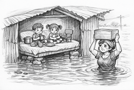
You see, this resident must make sure they have put enough stones under their bed to raise it up so if the flood water comes into the house, that little space between their bed and roof can be their haven. This little modification can mean the difference between sleeping dry or submerged. Every household knows the drill: certificates, national IDs, children’s birth certificates; these documents are kept in backpacks, ready to be grabbed at a moment’s notice. Children learn early that in a flood or fire, the bag comes first. This is resilience born of necessity. But it should not be the extent of our collective response.
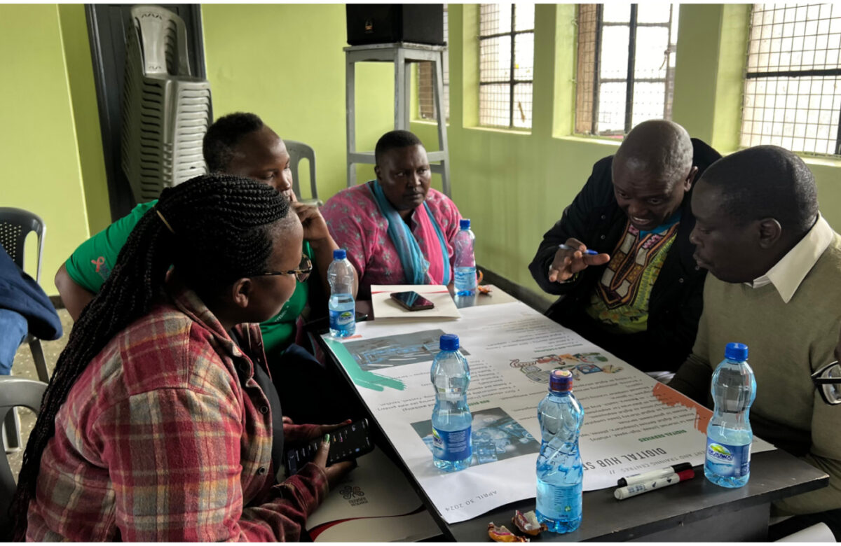
Mukuru Exloratory Scenario Planning (Mukuru XSP)
It is Monday mid-morning and my colleagues and I are making our way around the settlement, following a successful participatory mapping session for a project on Mukuru Exploratory Scenario Planning (Mukuru XSP). The conversations that are taking place as we walk are what I would describe as the virtuous cycles of conversation where we mindfully agree that every year, we expect heavy rains between March to May, and the authorities also know this. In fact, this year, the Kenya Meteorological Department (KMD) has issued warnings quite early that have been accurate. We know the rains are coming, we know Mukuru is flood prone, and yet, there is nothing concrete done in terms of preparedness. The mwananchi (ordinary citizen) is the one who knows how to modify the exteriors and interiors of their home to flood proof in the basic ways. As we make way to see some homes halfway submerged in the now stagnant water, we encounter am area with what appears to be schoolbooks aired out to dry in the sun. We are then told that this building is a school, and children left their books in their desks on Friday and because of the rains, the books are now wet, aired out to dry and there is no sight of children in school today.
The residents who are kind enough to accompany us on this walk are now having conversations amongst themselves, trying to understand why the floods seem to be more intense this year. Some insist that the embarkment that has been put along the river riparian in Mukuru kwa Ruben is what is causing the flooding; given that the surface run off has no way to drain into the river path. The Ruben residents argue that the river would burst into the settlement and hence the embarkment was ideated to prevent that. Both perspectives reflect a deeper truth, that in the absence of integrated planning, communities are left to interpret, adapt and survive as best they can. What struck me most during this visit was the multiplicity of roles residents must assume. In an era where every flood season brings devastation, the mwananchi must function as the environmental officer, flood expert and engineer all while trying to earn a living and keep their family safe. This is not empowerment; it is abandonment by design.
Unfortunate Timing
Our timing has fortunately or unfortunately coincided with the long rains in Kenya and subsequently the flooding that takes place in this community almost every year. I have mixed feelings as we sit in this story telling circles and people are recounting stories of loss and displacement. I am saddened by how desensitized some of these people are, and I realize that in that moment, we were not just researchers that day, we were witnesses and in some small way, makeshift therapists offering space for burdens too rarely voiced.
In moments like this, I feel the weight of my own profession, because a planner and researcher has been taught how to understand situations, analyze and propose recommendations but I feel overwhelmed in this moment, not knowing what kind of a contribution I can make, surrounded by people who have learnt how to sleep standing in partially submerged homes. And yet, one truth remains: that we are all human. It is this shared humanity, and a commitment to honoring the stories entrusted to us that will carry me through the analysis ahead. The data we gathered in those sessions is more than information; it is lived experience demanding to be translated into action. I hold onto the belief that these findings will contribute to meaningful change in Mukuru.
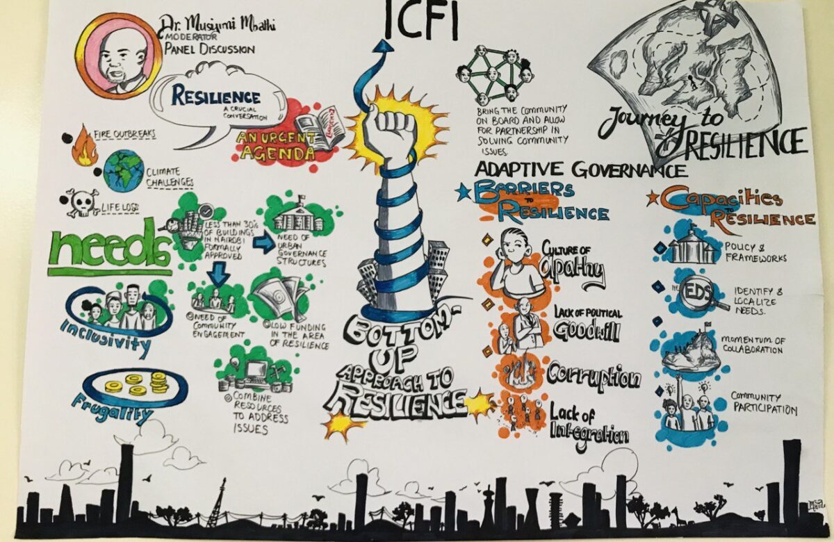
This experience reaffirmed why the Mukuru XSP Project matters. Traditional planning assumes predictability. Scenario planning embraces uncertainty. By bringing together community members, government actors, practitioners and researchers, we are working to co-develop frameworks that move beyond reactive coping toward anticipatory resilience. But frameworks alone are insufficient. The question we must collectively answer is this: Why do we continue to treat recurring disasters as emergencies rather than predictable events requiring structural solutions?
Disruption and Resilience
Informal settlements are not isolated enclaves, they are integral to the urban ecosystem. Their exclusion from formal planning and investment has cascading implications for the entire city. Floods in Mukuru disrupt livelihoods, displace workers and strain public services that ripple across Nairobi. Let us recognize that resilience is not something communities should have to engineer alone, stone by stone, bed by bed.